Home
WebLakes.com
WebMET
Terrain Data
US
7.5-min DEM
1-deg DEM
SRTM1
Global
SRTM3
SRTM30
GTOPO30
LULC Data
US
Shapefile (Lat/Long)
Shapefile (UTM)
Standard (UTM)
NLCD92
Global
GLCC
Base Maps
US
DLG Data
Terra Server
Libre Map Project
Global
LandSat (MrSID)
USGS Seamless
Shoreline Data
Global
GSHHS
Contact
About


Terrain data

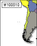
Worldwide - GTOPO30 Format

Click on desired region to download terrain data

Return to Global Map


Air Dispersion
Modeling & Risk
Assessment


#1 Meteorological Resource Center


courses
courses
CALPUFF View
Advanced Air Dispersion Model


Home | Terrain Data | LULC Data | Base Maps | Shoreline Data | Contact | About

Copyright © 2002-2009 Lakes Enviornmental Software
www.WebLakes.com | www.webGIS.com | www.WebMET.com