Resolution: ~900 m, 30 arc-sec Coverage: Global Projection: Geographic Datum: WGS84 Vertical Units: Meter
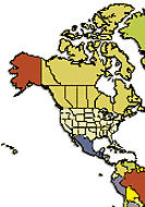
Click on desired area for a more detailed map
GTOPO30 is a global digital elevation model (DEM) produced by the U.S. Geological Survey (USGS) with a horizontal grid spacing of 30 arc seconds (approximately 1 kilometer). GTOPO30 was derived from several raster and vector sources of topographic information. For easier distribution, GTOPO30 has been divided into tiles which can be selected from the map shown above. Detailed information on the characteristics of GTOPO30 including the data distribution format, the data sources, production methods, accuracy, and hints for users, is found in the GTOPO30 README file.